Of course, it would be very useful especially for people who live in urban areas where they become subscriptions for traffic jams. By knowing the current situation of the highway, we can determine which route is best so as not to get caught in a long traffic jam.
How to check traffic jam with Google Maps
We just need to enable the feature to monitor traffic conditions on the highway. But because we will use the GPS service of course also requires a name internet connection. So before you try, make sure your smartphone is connected to the network.
1. First you please just open the Google Maps application.
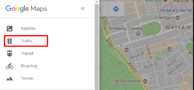
2. After that wait and will display the map in your area, press menu in the upper left corner then click Traffic.

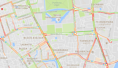
3. Automatically, Google Maps will show the condition of the highway there. This is a real-time condition right then and there so it's very trustworthy.

4. Now you can find out which path has traffic density and not.
You need to know:
When this feature is enabled, Google Maps will alert the congestion with color. For those who do not know the meaning please check the following explanation:
Green: Traffic situation is smooth without any traffic jam.
Orange: The road conditions are quite crowded with vehicles.
Red: Indicates the highway is jamming.
In addition to some color symbols above, there are also other symbols that indicate something happened there. For example, such as an accident, road repair or transfer/road closure. This information will certainly help you who often travel and do not want stuck in traffic.


